Two questions about the Atlanta campus have long puzzled me, and finally I have the answer to one. It concerns the chunk of land that was the original nugget of today’s 740-acre campus (not counting the 42 acres of the Briarcliff property a mile away).
In addition to his initial million-dollar gift to help launch the new university in Atlanta, Asa Candler Sr. arranged to convey to Emory 75 acres belonging to Druid Hills, Inc., the corporation through which he was developing the suburb six miles from downtown Atlanta. On March 31, 1915, the university board of trustees voted, in the words of the minutes, that “the property known as the ‘Guess Place,’ located in Druid Hills, be selected as the site of the University, provided it could be secured.”
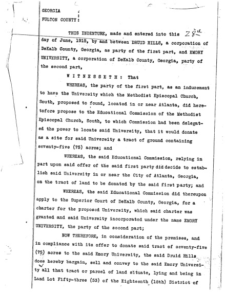
On June 28, 1915, Asa Candler, president of Druid Hills, Inc., saw to it that the land was indeed “secured.” Below, courtesy of the University’s Office of General Counsel, is a copy of the first page of the deed with that date.

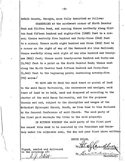
I’d always assumed that the original property included the Quadrangle, but was that correct? The second page of the deed tells more:

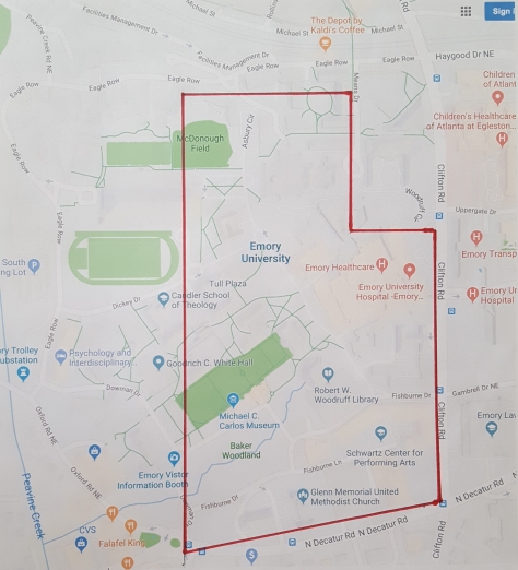
The first paragraph above describes the exact boundaries of the property. Using Google Maps and a scale of 200 feet to half an inch, I traced as nearly as I could the boundaries laid out by the deed. Surprisingly, here is what I found:

It’s interesting that those 75 acres did not include the corner at Clifton and Eagle Row, where the Woodruff Health Sciences Center now stands, or even the land where the Anatomy and Physiology laboratories would be built in 1917 (current site of the School of Medicine). More curious still, the western boundary appears to cut through the edge of the Quadrangle at about where architect Henry Hornbostel would locate the Old Theology Building.
Nine years later, the board minutes of May 30, 1924, indicate that Druid Hills, Inc., deeded to Emory an additional 55 acres, extending the western boundary of the campus to “Lullwater Creek.” That probably was what we today call Peavine Creek, which flows through Emory Village and north toward South Peachtree Creek. (Peavine Creek and Lullwater Creek meet up near the 15th tee of the Druid Hills Golf Club, just south of Emory Village. To my inexpert eye, it appears that Peavine actually flows into Lullwater, and that Lullwater continues on, and maybe folks in 1924 thought the same thing.)
By 1936, according to historian Henry Morton Bullock, in his centennial history of Emory, “subsequent additions” had “increased the campus to 235 acres.”
Now to take up the second question–who was that Guess for whom “the Guess place” was named?
Gary Hauk

One thought on “About those 75 acres”